The River Access Network includes eight locations across Brisbane.
Before using a hub, make sure you check its size capacity and the weight of your vessel.
View individual river hub locations for more details.
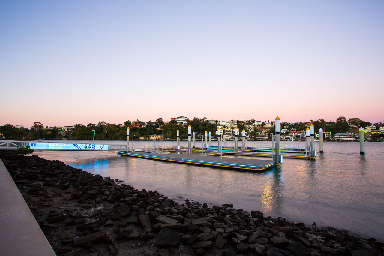
New Farm Park River Hub
Location: New Farm Park, 137 Sydney Street, New Farm.
Waterway access information: External side of the outer pontoon is intended for use by commercial and tour boat vessels of up to 200 tonnes. Inner pontoons are intended for passive and recreational vessels of up to 25 tonnes.
Find out more about the New Farm Park River Hub.
City Botanic Gardens River Hub
Location: City Botanic Gardens, 147 Alice Street, Brisbane City
Waterway access information: External side of the outer pontoon is intended for use by commercial and tour boat vessels of up to 200 tonnes. Inner pontoons are intended for passive and recreational vessels of up to 25 tonnes.
Find out more about the City Botanic Gardens River Hub.
Murarrie Recreation Hub
Location: 55 Metroplex Avenue (no 55) Park, 55 Metroplex Ave, Murarrie.
Waterway access information: Suitable for vessels up to 75 tonnes. Access the hub via a shared path through Metroplex Avenue Park, behind the Brewdog complex.
Status: open
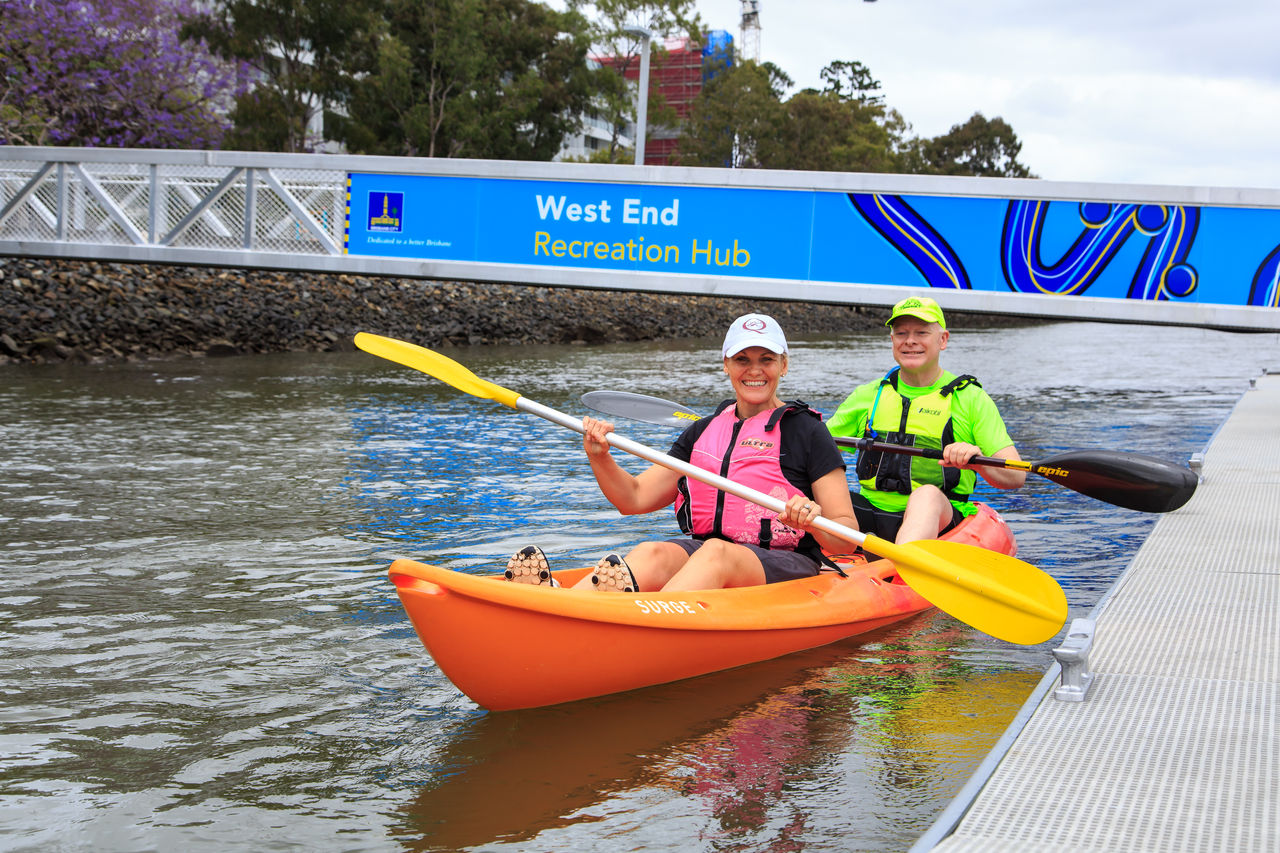
West End Recreation Hub
Location: West End Riverside Lands Park, 60 Kurilpa Street, West End.
Waterway access information: Suitable for vessels up to 75 tonnes.
Status: open
Dutton Park Recreation Hub
Location: Dutton Park, 359 Gladstone Road, Dutton Park.
Waterway access information: Suitable for vessels up to 75 tonnes.
Status: Open
Northshore Hamilton Recreation Hub
Location: Northshore Riverside Park, 305 Macarthur Avenue, Hamilton.
Waterway access information: Suitable for vessels up to 75 tonnes, single pontoon
Status: open
Kingsford Smith Drive Recreation Hub
Location: Kingsford Smith Drive Recreation Hub, 402 Kingsford Smith Drive, Hamilton.
Waterway access information: Suitable for vessels up to 300 tonnes. Access the hub via Lores Bonney Riverwalk.
Status: open
Riverhills Recreation Hub
Location: end of Sumners Road, in Newcomb Park, Riverhills.
Waterway access information: Pick-up and drop-off for commercial vessels up to 25 tonnes. Launching and short-term use of passive crafts such as kayaks, canoes and stand-up paddleboards
The facility allows users to stay for a period of up to two hours, unless otherwise signed by Council. The facility is suitable for vessels up to 25 tonnes.
Fishing is currently allowed on the pontoon, however, boating activities take priority. Cast nets and crab potting are not permitted on the pontoon to ensure the safety of all users.